Blizzard warnings up for Philly, all of New Jersey and Delaware
Published in News & Features
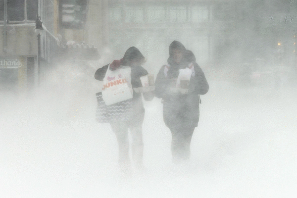
Blizzard warnings are in effect for the Philly area and all of New Jersey and Delaware Sunday through Monday as a storm forecast to match the intensity of a Category 1 hurricane generates “potentially historic” snowfall amounts, the National Weather Service is warning.
A forecast that looked scary Saturday got scarier Sunday morning.
Officially, the weather service was calling for 14 to 20 inches in the region, with higher amounts possible and significant coastal flooding at the Shore, where the effects could be the most dramatic. Moderate to major flooding was expected, with onshore gusts perhaps exceeding 55 mph.
The weather service projections may be “a little bit high,” said Ray Martin, a lead meteorologist in the Mount Holly office, but, “We don’t want people to be under-warned, that’s for sure.”
Gusts of more than 45 mph are possible inland, and 60 mph at the Shore.
The governors of Pennsylvania, New Jersey, and Delaware all declared states of emergency.
The storm almost almost certainly will reach “bomb cyclone” status, said Cody Snell, meteorologist at the Weather Prediction Center in College Park, Md.
“It will very easily qualify,” he said.
Light rain continued falling into Sunday afternoon, mixing with wet snow in parts of the region. Temperatures at Philadelphia International Airport were near 40 degrees at noon. The rain was due to change to snow during the afternoon, and fall heavily after dark as temperatures drop.
Computers still were working out details, and amounts are likely to vary. “It’s a tricky forecast,” said Snell.
The track and intensity of the storm — which was not expected to ripen off the Southeast coast later in the day — will be factors, but so will “banding,” said Snell.
Narrow corridors of heavier snow are likely to form during the night, and areas under the bands are going to receive the highest amounts.
This also will be a “long duration” storm with its effects continuing well into Monday afternoon.
At the outset the snow will be wet, and thus likely to stick on trees and wires. The winds are forecast to peak during the night, raising the possibility of power outages, said Martin.
The blizzard warnings remain in effect until 6 p.m. Monday.
The Philadelphia School District preemptively announced that Monday would be a virtual-instruction day, and Camden decided to close schools, period.
This marked the first time ever the entire state of New Jersey was under a blizzard warning, said Judah Cohen, research scientist with the Massachusetts Institute of Technology.
Philadelphia’s last verified blizzard occurred in March 1993.
_____
©2026 The Philadelphia Inquirer. Visit inquirer.com. Distributed by Tribune Content Agency, LLC.


Comments